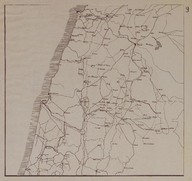
 | Route Map (Carte Routière) of the region including the region of Southern Lebanon, Southern Syria and the Northern British Mandate of Palestine and Transjordan (nowadays Israel and Jordan). | ‘Bureau Topographique de l’Armée Française du Levant’ (Topographic Office of French Army in the East) | 1924-11 |
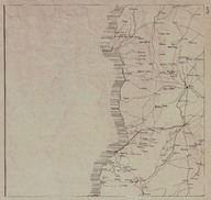 | Route Map (Carte Routière) of the Syrian and Lebanese coast region between the cities of Tripoli (Lebanon) and Latakia (Syria). | ‘Bureau Topographique de l’Armée Française du Levant’ (Topographic Office of French Army in the East) | 1924-11 |
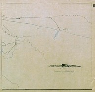
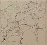 | Route Map (Carte Routière) of the region on the border between Turkey and Syria | ‘Bureau Topographique de l’Armée Française du Levant’ (Topographic Office of French Army in the East) | 1924-11 |
| Bulletin de Presse, issues 17-28. | - | 1925-11-29; 1926-02-14 |
| Bulletin de Presse, issues 144-158. | - | 1928-05-06; 1928-08-12 |
| Letter written by Colonel Tayar Bey, retired senior officer of Ottoman Army, to the ‘Tevhid-Efkiar’ editor in chief, concerning the figure of the Lieutenant Sarrou. | Colonel Tayar Bey, retired senior officer of Ottoman Army | 1921-11-06 |
| Bulletin de Presse, issues 29-40. | - | 1926-02-21; 1926-05-09 |
| Bulletin de Presse, issues 69-83. | - | 1926-11-30; 1927-03-06 |
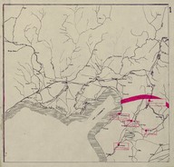 | Map of secretly allocated troops of the ‘Armée Française du Levant’ [French Army in the East]. The map shows the region around the Gulf of Iskenderun. | ‘Bureau Topographique de l’Armée Française du Levant’ (Topographic Office of French Army in the East) | 1924-12 |
 | Route Map (Carte Routière) of the Syrian Desert region on the border among Iraq, Jordan and Syria. | ‘Bureau Topographique de l’Armée Française du Levant’ (Topographic Office of French Army in the East) | 1924-11 |