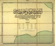
Tekfur Dağı [1:200.000]
| DC Field | Value | Language |
|---|---|---|
| dc.date.accessioned | 2018-09-22T15:39:02Z | - |
| dc.date.available | 2018-09-22T15:39:02Z | - |
| dc.date.issued | 1911 | |
| dc.identifier | APLEH049 | |
| dc.identifier.other | 42980 | |
| dc.identifier.uri | https://archives.saltresearch.org/handle/123456789/109094 | - |
| dc.description | Asya-yı Osmânî haritası. | |
| dc.format | 57,5-45 cm | |
| dc.language | Osmanlı Türkçesi - Ottoman Turkish | |
| dc.rights | Open Access | |
| dc.title | Tekfur Dağı [1:200.000] | |
| dc.type | Harita - Map | |
| dc.note | Sene: 1327. Evvelce iktişaf postaları tarafından tashih suretiyle ahz ve tersîm olunan Anadolu-i şahabe kısmı garbi paftaları ile dördüncü beşinci altıncı Ordu-yu Hümayûnların haritaları ve elde bulunan diğer hususi haritalar Erkân-ı Harbiye-i Umumiye Dördüncü Şubesince cem ve tevhid ve kâffesi 1:200.000 mikyâsına ircâ' ile tab edilmiştir. | |
| dc.location | SALT Research | |
| dc.catalogedby | HILALA | |
| dc.date.cataloged | 31.05.2004 | |
| dc.date.acquisition | 31.01.2003 | |
| dc.format.numberofscans | 1 | |
| dc.format.numberofpages | 1 | |
| dcterms.accrualMethod | Purchase | |
| dc.rights.holder | Erkan-ı Harbiye | |
| Collections | Erkan-ı Harbiye | |
Files
| File | Description | Size | Format | |
|---|---|---|---|---|
| APLEH049.jpg | 1 MB | JPEG |