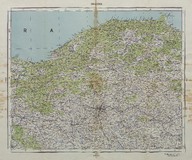
Ankara haritası (1:800000) - Map of Ankara (Scale 1:800000)
| DC Field | Value | Language |
|---|---|---|
| dc.contributor | Harita Umum Müdürlüğü - General Directorate of Mapping | |
| dc.date.accessioned | 2018-09-19T18:59:59Z | - |
| dc.date.available | 2018-09-19T18:59:59Z | - |
| dc.date.issued | 1956 | |
| dc.identifier | APLHUM034 | |
| dc.identifier.other | 108126 | |
| dc.identifier.uri | https://archives.saltresearch.org/handle/123456789/98265 | - |
| dc.format | 67,5-58 cm | |
| dc.format | Baskı-Renkli - Printing-Colored | |
| dc.language | Türkçe - Turkish | |
| dc.rights | Open Access | |
| dc.title | Ankara haritası (1:800000) - Map of Ankara (Scale 1:800000) | |
| dc.type | Harita - Map | |
| dc.note | 1936 basımlı harita üzerinde şose ve mülki teşkilatın revizyonu yapılarak 1956 yılında basılmıştır - The map was re-printed once more in 1956 by making the revision of the highways and civilian organization in 1936. | |
| dc.location | SALT Research | |
| dc.catalogedby | Sinem Gülmez | |
| dc.date.cataloged | 2012-07-30 | |
| dc.format.numberofscans | 1 | |
| dc.format.numberofpages | 1 | |
| dcterms.accrualMethod | Satın alma - Purchase | |
| Collections | Harita Umum Müdürlüğü | |
Files
| File | Description | Size | Format | |
|---|---|---|---|---|
| APLHUM034.jpg | 11 MB | JPEG |