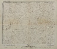
Türkiye jeolojik haritası: Çorum (1:100000) - Geologic map of Turkey: Çorum (1:100000)
| DC Field | Value | Language |
|---|---|---|
| dc.creator | Maden Tetkik ve Arama Enstitüsü Genel Direktörlüğü - General Directorate of Mineral Research and Exploration Institute (Turkey) | |
| dc.date.accessioned | 2018-09-19T09:25:51Z | - |
| dc.date.available | 2018-09-19T09:25:51Z | - |
| dc.date.issued | 1946 | |
| dc.identifier | APLMTA012 | |
| dc.identifier.other | 108166 | |
| dc.identifier.uri | https://archives.saltresearch.org/handle/123456789/97151 | - |
| dc.format | 60-49,6 cm | |
| dc.format | Baskı-Renkli - Printing-Colored | |
| dc.language | Türkçe - Turkish | |
| dc.publisher | Harita Genel Müdürlüğü Basımevi - Turkish Geodetical Survey Printing House | |
| dc.rights | Open Access | |
| dc.subject | Çorum | |
| dc.title | Türkiye jeolojik haritası: Çorum (1:100000) - Geologic map of Turkey: Çorum (1:100000) | |
| dc.type | Harita - Map | |
| dc.location | SALT Research | |
| dc.catalogedby | Sinem Gülmez | |
| dc.date.cataloged | 2012-07-30 | |
| dc.format.numberofscans | 1 | |
| dc.format.numberofpages | 1 | |
| dcterms.accrualMethod | Satın alma - Purchase | |
| Collections | The Institute of Mineral Research and Exploration | |
Files
| File | Description | Size | Format | |
|---|---|---|---|---|
| APLMTA012.jpg | 5.45 MB | JPEG |