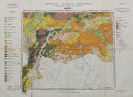
Türkiye jeoloji haritası: Hatay (1:500000) - Geology map of Turkey: Hatay (1:500000)
| DC Field | Value | Language |
|---|---|---|
| dc.contributor | Tertipleyen - Edited by: Cahit Erentöz. Kompilasyonu derleyen - Compiled by: Necip Tolun. 1: 100.000 ölçekli orijinal jeoloji haritalarında çalışanlar - Geologists who worked on the original 1:100.000 scale geological maps: Ş. Abdüsselamoğlu, M. Blumenthal, L. Dubertret, H. Holzer, C. Erentöz, L. Erentöz, S. Erk, W. Niehoff, I. Ortynski, V. Stchepinsky, N. Tolun, M. Topkaya, S. Türkünal, Z. Ternek, H. Vautrin. | |
| dc.creator | Maden Tetkik ve Arama Enstitüsü tarafından yapılmış ve yayınlanmıştır - Prepared and published by the Institute of Mineral Research and Exploration Ankara-Turkey. | |
| dc.date.accessioned | 2018-09-19T09:25:45Z | - |
| dc.date.available | 2018-09-19T09:25:45Z | - |
| dc.date.issued | 1962 | |
| dc.identifier | APLMTA006 | |
| dc.identifier.other | 108160 | |
| dc.identifier.uri | https://archives.saltresearch.org/handle/123456789/97150 | - |
| dc.format | 85-59,5 cm | |
| dc.format | Baskı-Renkli - Printing-Colored | |
| dc.language | Türkçe - Turkish | |
| dc.language | İngilizce - English | |
| dc.publisher | Harita Genel Müdürlüğü Matbaası'nda basılmıştır, Ankara - Printed by the Turkish Geodetical Survey, Angora. | |
| dc.rights | Open Access | |
| dc.title | Türkiye jeoloji haritası: Hatay (1:500000) - Geology map of Turkey: Hatay (1:500000) | |
| dc.type | Harita - Map | |
| dc.location | SALT Research | |
| dc.catalogedby | Sinem Gülmez | |
| dc.date.cataloged | 2012-07-30 | |
| dc.format.numberofscans | 1 | |
| dc.format.numberofpages | 1 | |
| dcterms.accrualMethod | Satın alma - Purchase | |
| Collections | The Institute of Mineral Research and Exploration | |
Files
| File | Description | Size | Format | |
|---|---|---|---|---|
| APLMTA006.jpg | 8.47 MB | JPEG |