SEARCH
FILTER
REFINE
1-8 / 8
- 1
| Preview | Title | Creator | Issue Date |
|---|---|---|---|
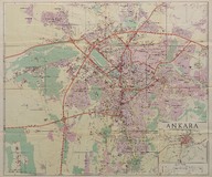 | Ankara haritası (Ölçek 1:15000) - Map of Ankara (Scale 1:15000) | - | 1967 |
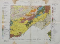 | Türkiye jeolojik haritası, Adana - Geological map of Turkey, Adana (1:100000) | Maden Tetkik ve Arama Enstitüsü hazırlanmış ve yayınlamıştır - Prepared and published by the Institute of Mineral Research and Exploration (Turkey). | 1962 |
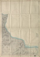 | Ordu - Perşembe (Ölçek - Scale 1:25000) | - | 1963-08-16 |
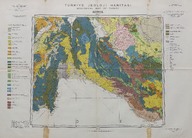
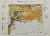 | Türkiye jeoloji haritası: Hatay (1:500000) - Geology map of Turkey: Hatay (1:500000) | Maden Tetkik ve Arama Enstitüsü tarafından yapılmış ve yayınlanmıştır - Prepared and published by the Institute of Mineral Research and Exploration Ankara-Turkey. | 1962 |
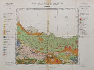 | Türkiye jeoloji haritası: Samsun (1:500000) - Geology map of Turkey, Samsun (Scale 1:500000) | Maden Tetkik ve Arama Enstitüsü tarafından yapılmış ve yayınlanmıştır - Prepared and published by the Institute of Mineral Research and Exploration Ankara-Turkey. | 1962 |
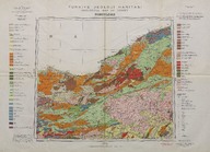 | Türkiye jeoloji haritası: Zonguldak (1:500000) - Geology map of Turkey: Zonguldak (1:500000) | Maden Tetkik ve Arama Enstitüsü tarafından yapılmış ve yayınlanmıştır - Prepared and published by the Institute of Mineral Research and Exploration Ankara-Turkey. | 1964 |
 | Türkiye jeolojik haritası, Konya - Geological map of Turkey, Konya (1:500000) | Maden Tetkik ve Arama Enstitüsü hazırlanmış ve yayınlamıştır - Prepared and published by the Institute of Mineral Research and Exploration (Turkey). | 1963 |
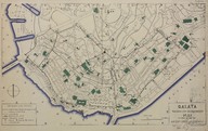 | Galata'nın Topografik ve Arkeolojik Planı - Galata Topographisch-Archaologischer plan mit erlauterndem text von A.M. Schneider und M. Is. Nomidis [İstanbul] - Topographical and Archaeological Plan of Galata | - | 1944; 1965-05-26 |
1-8 / 8
- 1