SEARCH
FILTER
REFINE
| Preview | Title | Creator | Issue Date |
|---|---|---|---|
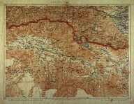
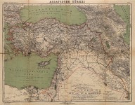 | Asiatische Türkei. Kiepert's Grosser Handatlas No: 31. [Berichtigt 1900 ] | Ernst Vohsen | 1900 |
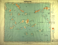 | Ege Adaları [1:500.000] | - | 1946 |
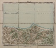
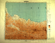 | Samsun [1:500.000] | - | 1946 |
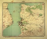 | Çanakkale [1:25.000] | - | 1915 |
 | Karakilise. Toprak Kale. [Ağrı] | - | - |
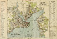 | Préfecture de la ville. Plan d'ensemble des quartiers, batiments et chemins principaux de communication de la ville de Constantinople [Échelle 1:17.500] | - | 1922 |
 | Sinop [1:500.000] | - | 1946 |
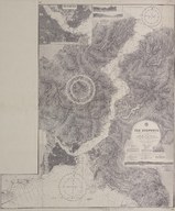 | The Bosporus (Bosphorus) | Surveyed by Messrs. C. H. Ploix and Manen 1854 under the direction of Admiral Hamelin of the French. | 1915-11-19 |
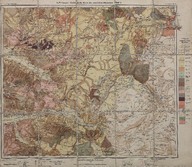 | Geologische Karte des westlichen Kleinasien. Blatt 4. (Maßstab 1:300000) - Batı Anadolu jeolojik haritası. Pafta 4 (Ölçek 1:300000) - Geological map of western Asia Minor. Sheet 4 (Scale 1:300000) | A. Philippson | 1913 |
 | Şile (5-H) (1:200000 yani bir santimetre iki kilometredir.) - Şile (5-H) (Scale 1:200.000, one centimeter equals two kilometers.) | - | 1902; 1903 |