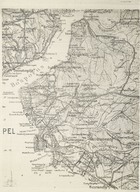
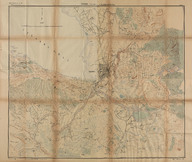
 | 1912-1913 İşkodra Müdafaası. İşkodra Civarının 1:25.000 m. haritası. | - | 1934 |
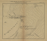 | 1912-1913 İşkodra Müdafaası. 1:2000 nisbetinde ahz olunan Şingin Liman ve civar arazisinin bir kıt'a krokisidir. | - | - |
| Bölümsel İstanbul haritası - Partial Istanbul map | - | - |
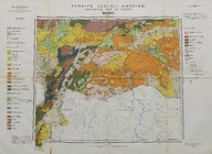 | Türkiye jeoloji haritası: Hatay (1:500000) - Geology map of Turkey: Hatay (1:500000) | Maden Tetkik ve Arama Enstitüsü tarafından yapılmış ve yayınlanmıştır - Prepared and published by the Institute of Mineral Research and Exploration Ankara-Turkey. | 1962 |
 | Türkiye jeolojik haritası: Çorum (1:100000) - Geologic map of Turkey: Çorum (1:100000) | Maden Tetkik ve Arama Enstitüsü Genel Direktörlüğü - General Directorate of Mineral Research and Exploration Institute (Turkey) | 1946 |
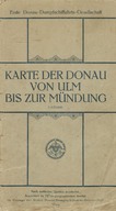
| Karte der Donau von Ulm bis zur Mündung (1:125.000) - Tuna Nehri'ni kaynağından Ulm şehrine kadar gösteren harita (1:125.000) - Map showing Tuna River from headwaters to Ulm city (1:125.000). | - | - |
 | Türkiye jeolojik haritası: Sivrihisar (1:100000) - Geologic map of Turkey: Sivrihisar (1:100000) | Maden Tetkik ve Arama Enstitüsü Genel Direktörlüğü - General Directorate of Mineral Research and Exploration Institute (Turkey) | 1946 |
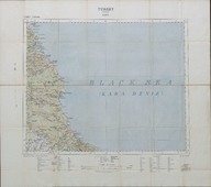
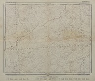
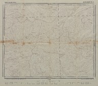
| Vize, Turkey (Echelle: 1:1,250,000) - Vize, Türkiye (Ölçek: 1:1,250,000) | War Office | 1909-01 |
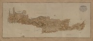 | Girid Cezire-i harita - Girit Adası haritası. [1/292.000] | - | 1891 |
| Vue générale d'Angora. Bosphore vue panoramique. Vue générale de Constantinople. | - | - |