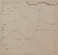
 | Route Map (Carte Routière) of the region is east of Homs (Syria). | ‘Bureau Topographique de l’Armée Française du Levant’ (Topographic Office of French Army in the East) | 1924-11 |
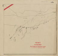 | Map of secretly allocated troops of the ‘Armée Française du Levant’ [French Army in the East]. The map shows the Syrian Desert region encompassing the territory from the west of Baghdad to Syrian border. | ‘Bureau Topographique de l’Armée Française du Levant’ (Topographic Office of French Army in the East) | 1924-12 |
 | Map of secretly allocated troops of the ‘Armée Française du Levant’ [French Army in the East]. The map shows the Syrian Desert region on the border among Iraq, Jordan and Syria. | ‘Bureau Topographique de l’Armée Française du Levant’ (Topographic Office of French Army in the East) | 1924-12 |
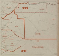
 | Map of secretly allocated troops of the ‘Armée Française du Levant’ [French Army in the East]. The map shows the region on the border between Turkey and Syria. | ‘Bureau Topographique de l’Armée Française du Levant’ (Topographic Office of French Army in the East) | 1924-12 |
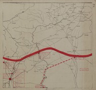
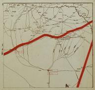
 | Map of secretly allocated troops of the ‘Armée Française du Levant’ [French Army in the East]. The map shows the region is east of Homs (Syria). | ‘Bureau Topographique de l’Armée Française du Levant’ (Topographic Office of French Army in the East) | 1924-12 |
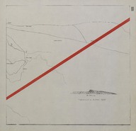
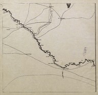 | Route Map (Carte Routière) of the region between the city of Deir ez-Zor (Syria) and the Syrian-Iraqi border. | ‘Bureau Topographique de l’Armée Française du Levant’ (Topographic Office of French Army in the East) | 1924-11 |
 | Route Map (Carte Routière) of the northern-eastern region of Syria. | ‘Bureau Topographique de l’Armée Française du Levant’ (Topographic Office of French Army in the East) | 1924-11 |
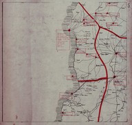 | Map of secretly allocated troops of the ‘Armée Française du Levant’ [French Army in the East]. The map shows the Syrian and Lebanese coast region between the cities of Tripoli (Lebanon) and Latakia (Syria). | ‘Bureau Topographique de l’Armée Française du Levant’ (Topographic Office of French Army in the East) | 1924-12 |
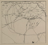
 | Map of secretly allocated troops of the ‘Armée Française du Levant’ [French Army in the East]. The map shows the north-eastern region of Syria. | ‘Bureau Topographique de l’Armée Française du Levant’ (Topographic Office of French Army in the East) | 1924-12 |
| Bulletin de Presse, issues 41-53. | - | 1926-05-16; 1926-08-08 |