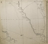
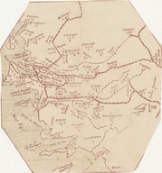
 | Map of secretly allocated troops of the ‘Armée Française du Levant’ [French Army in the East]. The map shows the region including the territory of Southern Lebanon, Southern Syria and the Northern British Mandate of Palestine and Transjordan | ‘Bureau Topographique de l’Armée Française du Levant’ (Topographic Office of French Army in the East) | 1924-12 |
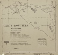 | Route Map (Carte Routière) of the region is south-west of Baghdad (Iraq). | ‘Bureau Topographique de l’Armée Française du Levant’ (Topographic Office of French Army in the East) | 1924-11 |
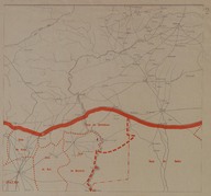 | French Mandate of Syria and Lebanon Province Map. The map shows the region on the border between Turkey and Syria (in the extreme corners of the map there are placed the cities of Aleppo -Syria- and Siverek –Turkey-). | ‘Bureau Topographique de l’Armée Française du Levant’ (Topographic Office of French Army in the East) | - |
 | Route Map (Carte Routière) of the Syrian Desert region encompassing the territory from the west of Baghdad to Syrian border. | ‘Bureau Topographique de l’Armée Française du Levant’ (Topographic Office of French Army in the East) | 1924-11 |
 | Route Map (Carte Routière) of the region is north of Baghdad (Iraq). | ‘Bureau Topographique de l’Armée Française du Levant’ (Topographic Office of French Army in the East) | 1924-11 |
 | Route Map (Carte Routière) of the region including the region of Southern Lebanon, Southern Syria and the Northern British Mandate of Palestine and Transjordan (nowadays Israel and Jordan). | ‘Bureau Topographique de l’Armée Française du Levant’ (Topographic Office of French Army in the East) | 1924-11 |
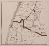
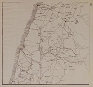
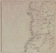 | Route Map (Carte Routière) of the Syrian and Lebanese coast region between the cities of Tripoli (Lebanon) and Latakia (Syria). | ‘Bureau Topographique de l’Armée Française du Levant’ (Topographic Office of French Army in the East) | 1924-11 |
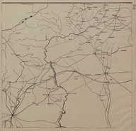 | Route Map (Carte Routière) of the region on the border between Turkey and Syria | ‘Bureau Topographique de l’Armée Française du Levant’ (Topographic Office of French Army in the East) | 1924-11 |
 | Ege Bölgesi haritası | - | - |
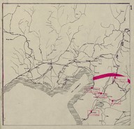 | Map of secretly allocated troops of the ‘Armée Française du Levant’ [French Army in the East]. The map shows the region around the Gulf of Iskenderun. | ‘Bureau Topographique de l’Armée Française du Levant’ (Topographic Office of French Army in the East) | 1924-12 |