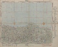
Şile, İstanbul (1:200000)
| DC Field | Value | Language |
|---|---|---|
| dc.contributor | Harita Genel Müdürlüğü - General Directorate of Mapping | |
| dc.date.accessioned | 2018-09-23T11:59:01Z | - |
| dc.date.available | 2018-09-23T11:59:01Z | - |
| dc.date.issued | 1946 | |
| dc.identifier | APLHUM035 | |
| dc.identifier.other | 108127 | |
| dc.identifier.uri | https://archives.saltresearch.org/handle/123456789/114910 | - |
| dc.description | Karadeniz, Kocaeli (İzmit), İstanbul | |
| dc.format | 59,7-49 cm | |
| dc.format | Baskı-Renkli - Printing-Colored | |
| dc.language | Türkçe - Turkish | |
| dc.rights | Open Access | |
| dc.subject | İstanbul | |
| dc.title | Şile, İstanbul (1:200000) | |
| dc.type | Harita - Map | |
| dc.note | 1:25.000 ölçekli haritalardan yol ve isim revizyonu yapılarak 1946 yılında basılmıştır - The map was re-printed by making the revision of the roads and names on the basis of the maps with scale 1:25.000 in 1946. | |
| dc.location | SALT Research | |
| dc.catalogedby | Sinem Gülmez | |
| dc.date.cataloged | 2012-12-31 | |
| dc.format.numberofscans | 1 | |
| dc.format.numberofpages | 1 | |
| dcterms.accrualMethod | Satın alma - Purchase | |
| Collections | Harita Umum Müdürlüğü | |
Files
| File | Description | Size | Format | |
|---|---|---|---|---|
| APLHUM035.jpg | 6.24 MB | JPEG |