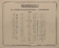
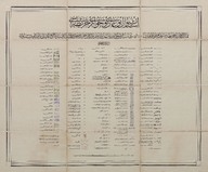
İstanbul Boğazı ve civarı haritası (1:25000) - Map of the Bosphorus and surroundings (1:25000).
| Dublin Core Alanı | Değer | Dil |
|---|---|---|
| dc.date.accessioned | 2018-09-22T12:57:58Z | - |
| dc.date.available | 2018-09-22T12:57:58Z | - |
| dc.date.issued | 1911 | |
| dc.date.issued | 1917 | |
| dc.identifier | APLEH063 | |
| dc.identifier.other | 108073 | |
| dc.identifier.uri | https://archives.saltresearch.org/handle/123456789/108011 | - |
| dc.description | Memalik-i Osmaniye Harita-i Muntazama Heyeti tarafından çizilmiştir - Drawn by Memalik-i Osmaniye Harita-i Muntazama Committee. | |
| dc.format | 60,5-50,5 cm 59-49,3 cm 59,5-49,5 cm | |
| dc.format | Baskı-Renkli - Printing-Colored | |
| dc.language | Osmanlı Türkçesi - Ottoman Turkish | |
| dc.publisher | Erkân-ı Harbiye-i Umûmiye | |
| dc.rights | Open Access | |
| dc.title | İstanbul Boğazı ve civarı haritası (1:25000) - Map of the Bosphorus and surroundings (1:25000). | |
| dc.type | Harita - Map | |
| dc.note | Sene-i maliye: 1327. Sene-i maliye: 1333. | |
| dc.location | SALT Research | |
| dc.catalogedby | Sinem Gülmez | |
| dc.date.cataloged | 2012-07-30 | |
| dc.format.numberofscans | 3 | |
| dc.format.numberofpages | 3 | |
| dcterms.accrualMethod | Satın alma - Purchase | |
| Koleksiyonlar | Erkan-ı Harbiye | |
Dosyalar
| Dosya | Tanım | Boyut | Biçim | |
|---|---|---|---|---|
| APLEH06301.jpg | 4.57 MB | JPEG | ||
| APLEH06302.jpg | 4 MB | JPEG | ||
| APLEH06303.jpg | 3.81 MB | JPEG |


